
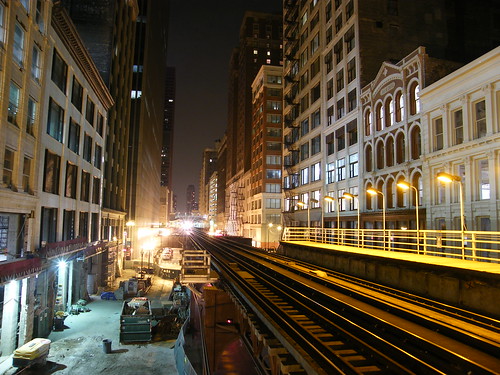
Took this shot using my mini-tripod at night after the Jazz Festival.
I set the ISO-setting on the digital camera to 64 and have the largest aperture possible (2.8) to get this crisp photo of the elevated train tracks in the Loop. I was waiting for a Brown Line train to take me up to Fullerton where I'd switch to a Red Line train to get me uptown.
Lots of people think that Chicago's "loop" neighborhood is named for this "loop" of elevated track that circles the central business district. In fact, it is named for all the streetcars, horse drawn cars, and cable (grip) cars that had to "loop back" to their origin once they reached the city's center.
The Chicago Loop has a population density of just over 10,000 people per square mile, making it one of the most densely populated zip codes in America. The high density in the loop gives Chicago part of its signature skyline.
Saturday, September 26, 2009
Chicago Loop at Night
Subscribe to:
Post Comments (Atom)


1 comment:
The Chicago Loop are the terms used to designate the historical center of downtown Chicago. Most accurately, the term refers to an area bounded by a public transit circuit along Lake Street on the north, Wabash Avenue on the east, Van Buren Street on the south, and Wells Street on the west, but in general use it refers to the whole central business district.
Post a Comment